 |
| We started at Knockatee around 10am, which is near the town called Tuosist on the map above, went east on R571 to N71 south to Glengarrif, to R572 west to the very point of the Peninsula, then back to Knockatee heading east on R575/571. Thanks for all the great driving Jubin! |
 |
| This was a random beautiful spot off of N71 - first pic of the day! |


 |
| While standing at the stone circle, Watson noticed these 2 Red Deer does - good eyes! Deer are NOT very common in ROI/NI - these are the 1st we've seen all year. |
 |
| More info about Red Deer here: http://www.wilddeerireland.com/reddeer.html |


 |
| Watson's face here was him saying something like "but, it is so small...I thought they were big!" |


There were a bunch of rock tunnels along N71 too - this was the road that we accidentally took on our first night when we were trying to get to Knockatee House. Cool during the day, not so much late at night after a long day!

Right before Glengariff, we stopped at Gelngariff Nature Reserve (http://www.glengarriffnaturereserve.ie/) for a picnic lunch. Was a perfect spot for it! Unfortunately, I didn't get any pix there, but it was really nice - picnic tables, woods, and a beautiful stream for the boys to play in. Unfortunately, no bathrooms...It certainly felt like we spent a lot of time during these 2 weeks searching for HC accessible bathrooms! Not the easiest to come by...
At the very tip of the Peninsula, you can take this cable car (seats 7) across to Dursey Island - so cool! We wanted to do the trip, but all of the return trips were booked until 7pm, so we would have had to wait 4 hours to get back...and, the island basically has nothing on it except hiking trails. Not this time around! But, we had a really nice time here, viewing the scenery and wildlife.


 |
| We still aren't sure what exactly we were watching in the Sea there...whale? Orca? Shark? Whatever it was, it was very large! And, it hung out for a long time while we watched. |


 |
| Random ring fort - so neat... In the pic below, it is in the background. |

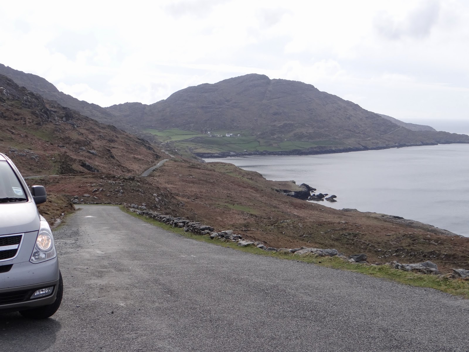 |
| This is what the road looked like - narrow, right along the edge of cliffs and hills. In the pic below, the same road starts in the left-hand corner and goes along into the middle of the pic. |

On the way back to Knockatee, we passed MANY places we wanted to explore...But, we had all had enough. Signing Time was playing in the back, Watson and my Mom were sick of being in the car, and Jubin was sick of driving.
No comments:
Post a Comment